GMV develops BEACON: More resilient satellite navigation for autonomous transport and logistics systems
The Spanish technology company GMV is working on a new navigation system designed to significantly improve the reliability of satellite-based positioning. The project, called BEACON, is being implemented under a funding programme of the European Space Agency (ESA) and is primarily aimed at future applications in autonomous transport and logistics. The goal is to make navigation signals usable even in environments where conventional satellite navigation reaches its limits.
At its core, BEACON is not about building a new satellite system, but about further developing the receiver side. GMV is developing an intelligent antenna and receiver solution intended to make navigation signals more robust and resilient to interference. The ESA project is being carried out by GMV UK together with the UK-based Loughborough University and is planned to run for 18 months.
Why conventional satellite navigation reaches its limits
Well-known systems such as GPS (Global Positioning System) from the United States or Galileo from Europe are based on satellites in medium Earth orbit. These transmit very weak radio signals to Earth in the so-called L-band. For many everyday applications, this technology is sufficiently precise. In complex environments – such as cities with tall buildings, industrial facilities or ports – problems occur frequently. Radio signals are reflected, blocked or superimposed. Unintentional radio interference or deliberate jamming and manipulation of signals can also impair positioning.
Such failures are particularly critical for autonomous vehicles, driverless transport systems or automated logistics processes. These applications require not only a position, but a continuously available and reliable combination of position, navigation and precise timing information. Experts refer to this as PNT: Positioning, Navigation and Timing.
What makes BEACON different
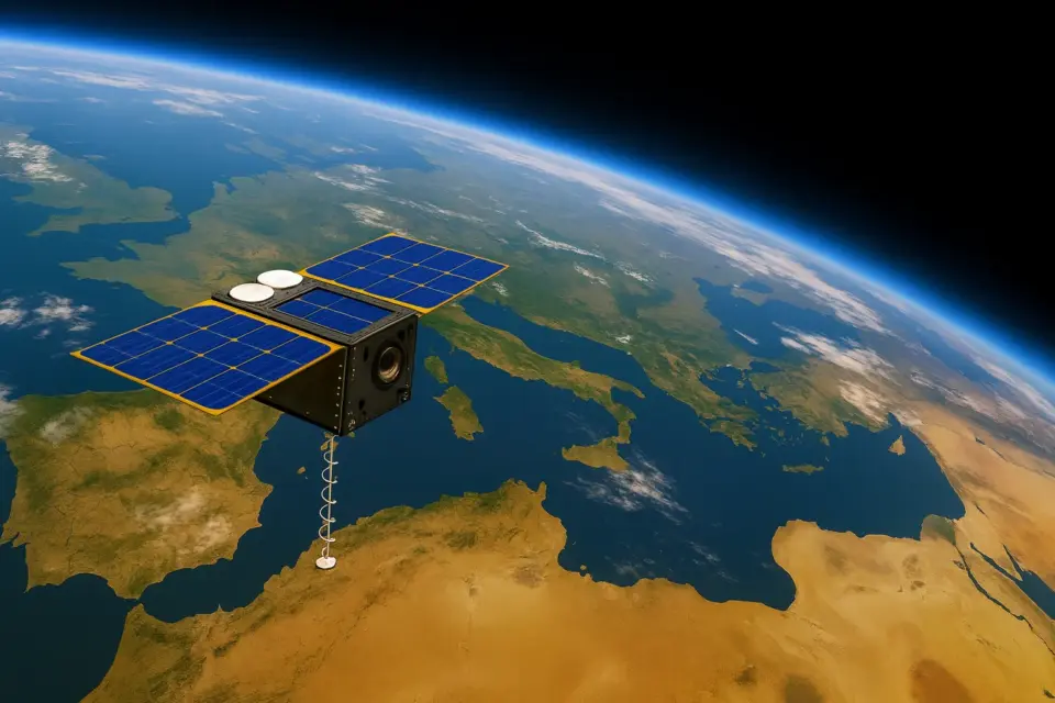
BEACON addresses these weaknesses directly. Instead of relying exclusively on conventional navigation signals from medium Earth orbit, the project uses signals from satellites in low Earth orbit (LEO). These satellites are much closer to Earth and therefore provide stronger signals.
Another key difference lies in the frequency range used. BEACON operates with signals in the C-band. This frequency range is considered more robust against certain types of interference than the commonly used L-band. Crucial, however, is the reception method: BEACON uses a so-called multi-array antenna with advanced signal processing. Using beamforming, the receiver can selectively amplify signals from a specific direction while suppressing interference from others. Additional techniques are used to determine the angle of arrival of signals in order to better identify manipulation or interference.
Complement rather than replacement for GPS and Galileo
BEACON is explicitly not intended as a replacement for GPS or Galileo. Rather, the project is designed as a complement to existing satellite navigation. Classical GNSS systems remain the basic infrastructure for global positioning. BEACON aims to make additional signals usable and to increase overall reliability, especially in challenging environments.
In the long term, a hybrid approach could emerge in which receivers evaluate both classical GNSS signals and new LEO-based navigation signals. This would reduce dependence on individual systems and increase resilience. For critical infrastructures, automated supply chains or autonomous vehicles, this would be an important step.
Future fields of application
The potential fields of application for BEACON are primarily those where precise and robust navigation is business- or safety-critical. These include autonomous trucks on industrial sites, driverless transport vehicles in logistics centres, autonomous ships in ports, as well as industrial applications in large production facilities. Reliable timing and positioning information also plays a central role in critical infrastructure sectors such as energy supply and telecommunications.
With BEACON, GMV aims to deliver a building block for the next generation of satellite-based navigation. The project shows that the future of navigation will not be decided solely in space, but increasingly through intelligent receiver technology on Earth.
Summary
- BEACON is an ESA project developed by GMV to improve the robustness of satellite-based navigation.
- The focus is not on a new satellite system, but on intelligent antenna and receiver technology.
- BEACON uses navigation signals from low Earth orbit (LEO) in the C-band, which are stronger and more resilient.
- The project complements existing systems such as GPS and Galileo, but does not replace them.
- Target applications include autonomous transport and logistics systems as well as critical infrastructures.